We utilize chronicling as a way to document, archive, and pass on information that can help us to understand how to better steward and engage with the land that we call home. Chronicling begins through intentional observation. Documenting what we learn about the land allows us to paint a picture and to tell a story of what the landscape is today — in order to track changes over time and to help us better understand the place we inhabit and our impact.
One of the richest offerings yet biggest struggles of the Arcosanti project, is the transient nature of the community. Chronicling the knowledge we are gaining helps us to address the issue of organizational amnesia that prompts us to have to relearn or “reinvent the wheel” far more often than necessary.
The land chronicles are meant to be a tool for the current and future stewards of the Arcosanti land.
WILDLIFE MONITORING
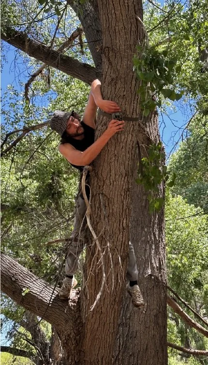
We placed motion activated cameras at different key habitats throughout the Arcosanti property. The observations from the cameras are recorded on a database to determine trends over seasons, years, and habitats. These documented observations will allow us to understand patterns, track species abundance, and identify the important and key habitats of our more-than-human neighbors. Ultimately the study will allow us to pinpoint areas of concern and possibility to aid in the development of better land management practices. The images and videos from the cameras are shared periodically with the Arcosanti community, thus seeding a further sense of curiosity and awe about the land we inhabit and its animate ways.
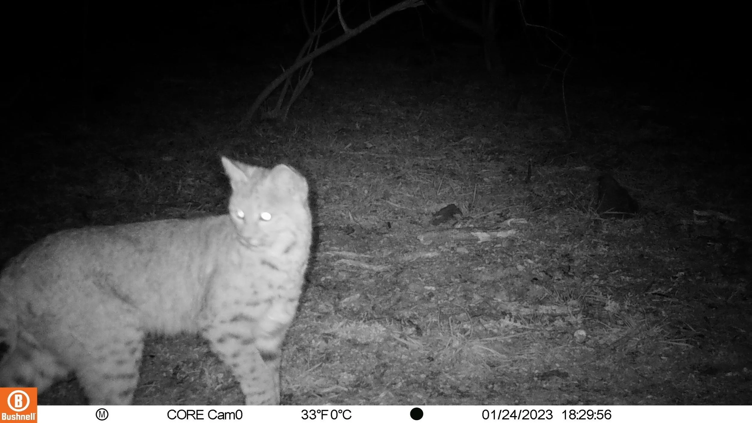
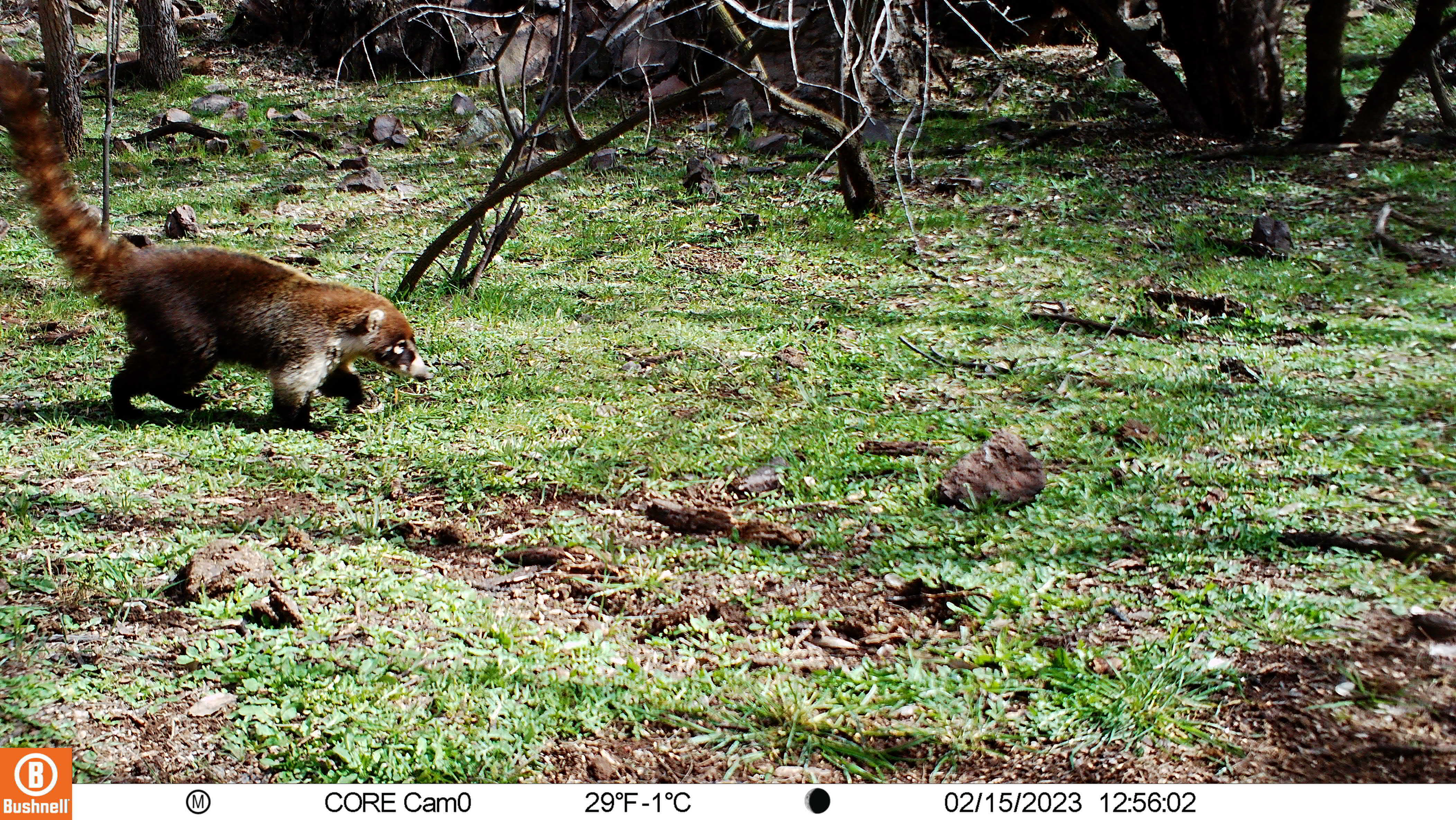
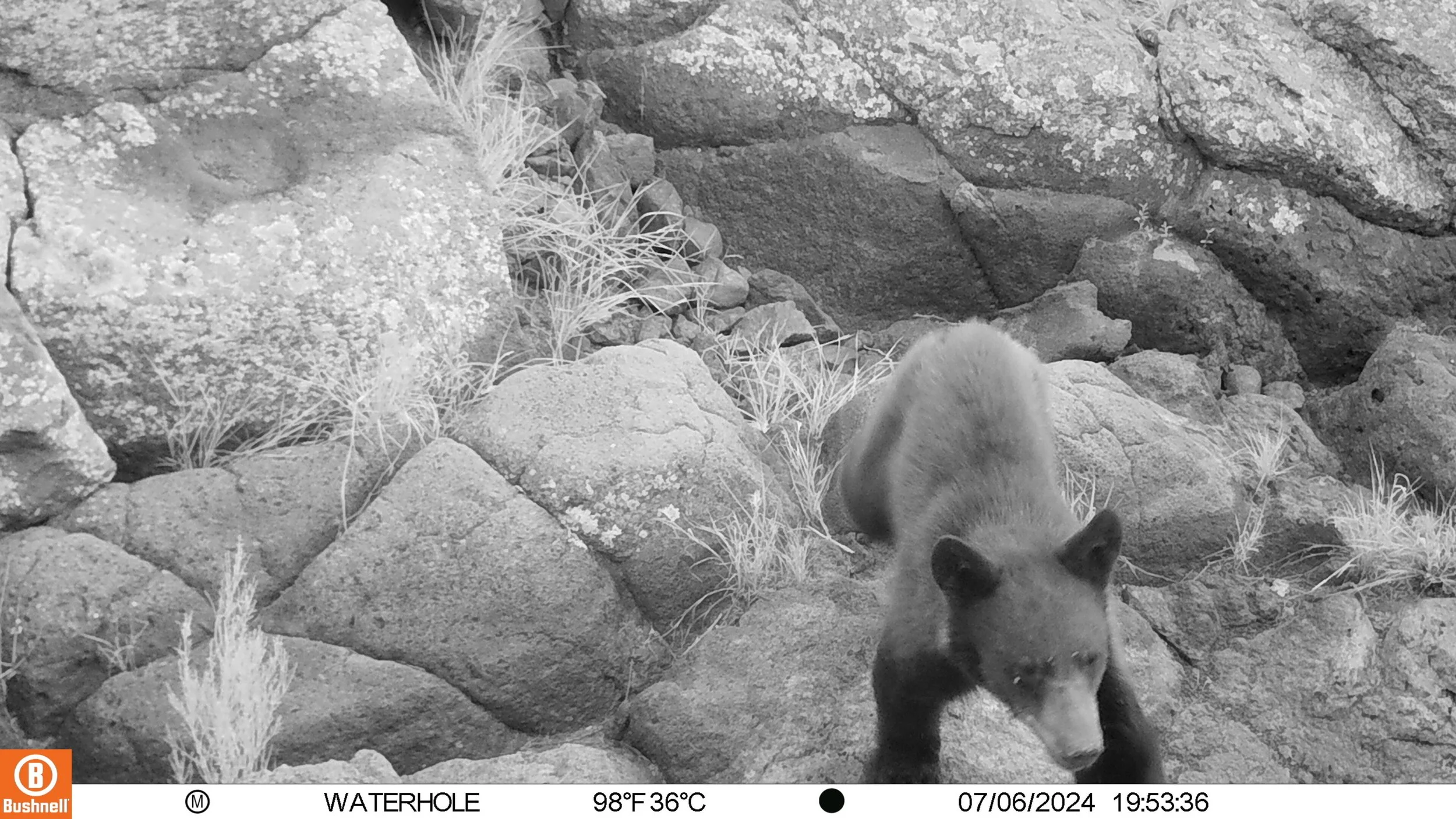
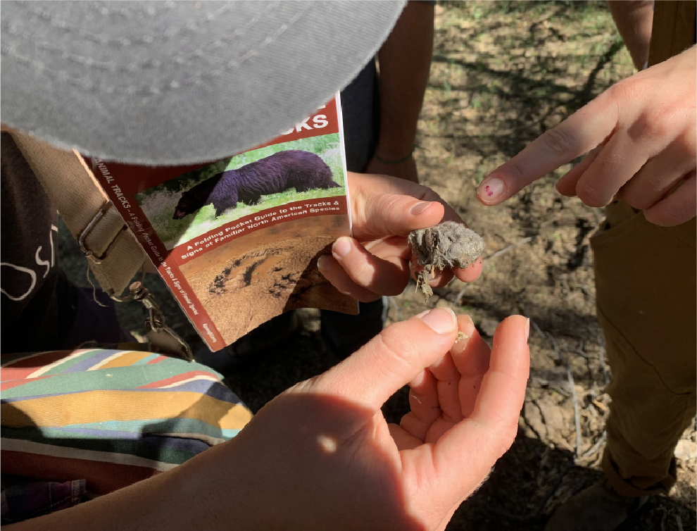
Scat Club was formed as a group of Arcosanti residents to periodically retrieve data from the wildlife monitoring cameras placed throughout the property. The club was born out of a desire to involve the community in the activities of the Land Stewardship program and collectively grow our appreciation and understanding of the land through hands-on experiences
SCAT
CLUB


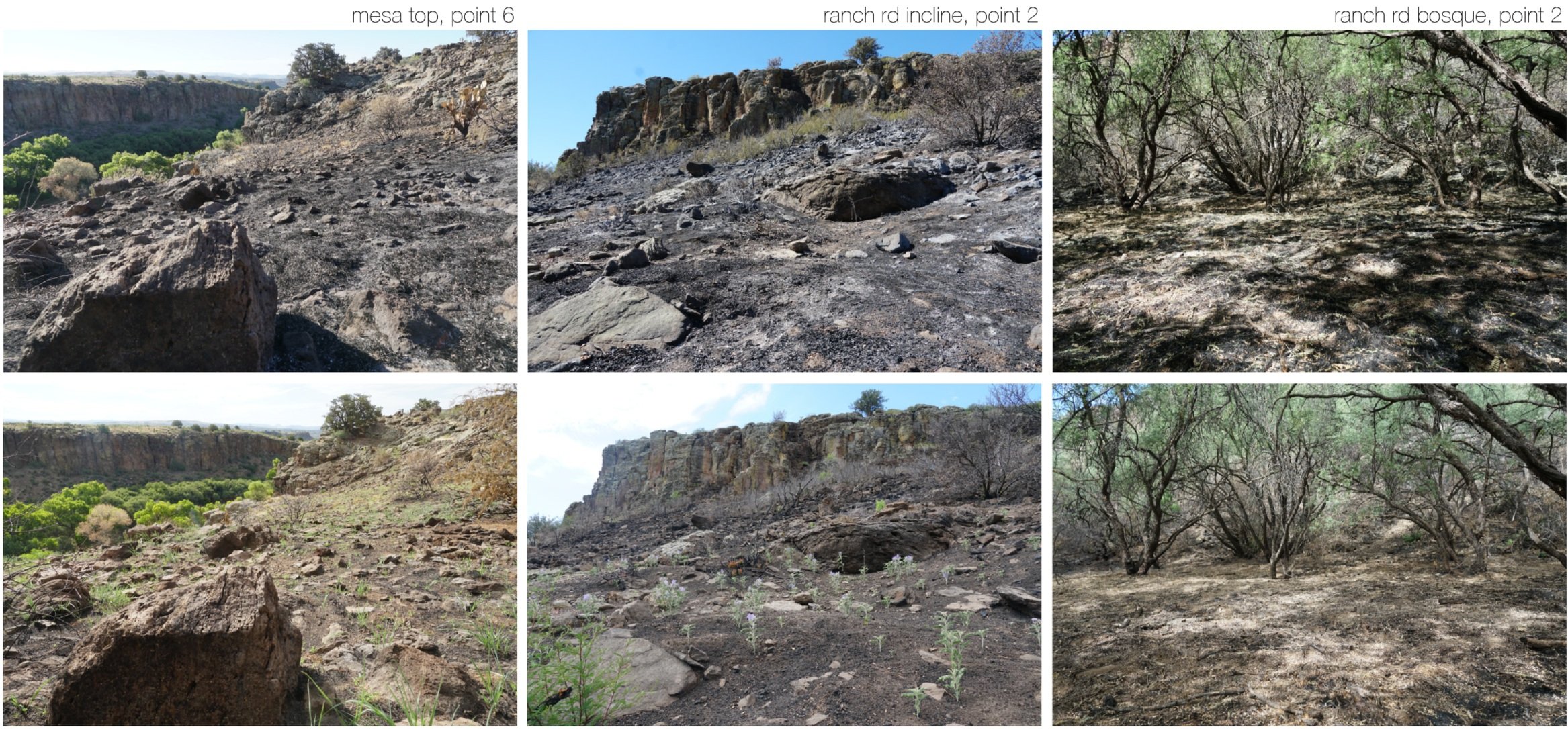
LAND PHOTO MONITORING
Different photographic monitoring points were established along the Riparian corridor, particularly in areas of concern where restoration activities are planned. The points are photographed periodically. The monitoring of these aspects of the land allow us to understand how quickly and in what manner the land is changing. This knowledge will allow us to understand the land better, prioritize restoration activities and track the impact/ success of the activities taking place.

Additional photo monitoring studies are conducted to learn more about the behavior of the ecosystem. Land Recovery is a study that took place after a brush fire burned through a portion of the Arcosanti property. The purpose of the study was to understand how the land recovers after such an event. Various monitoring points on areas affected by the fire were established and photographed. Special attention was placed on identifying which plant species are the first to emerge after a disruptive event.

PLANT DATABASE

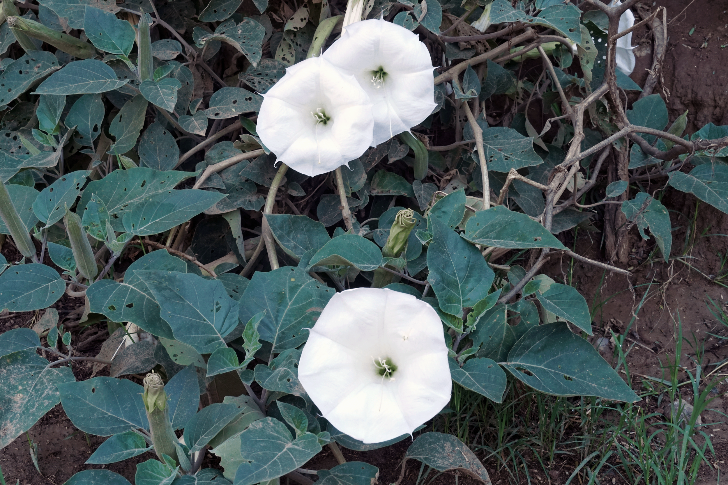
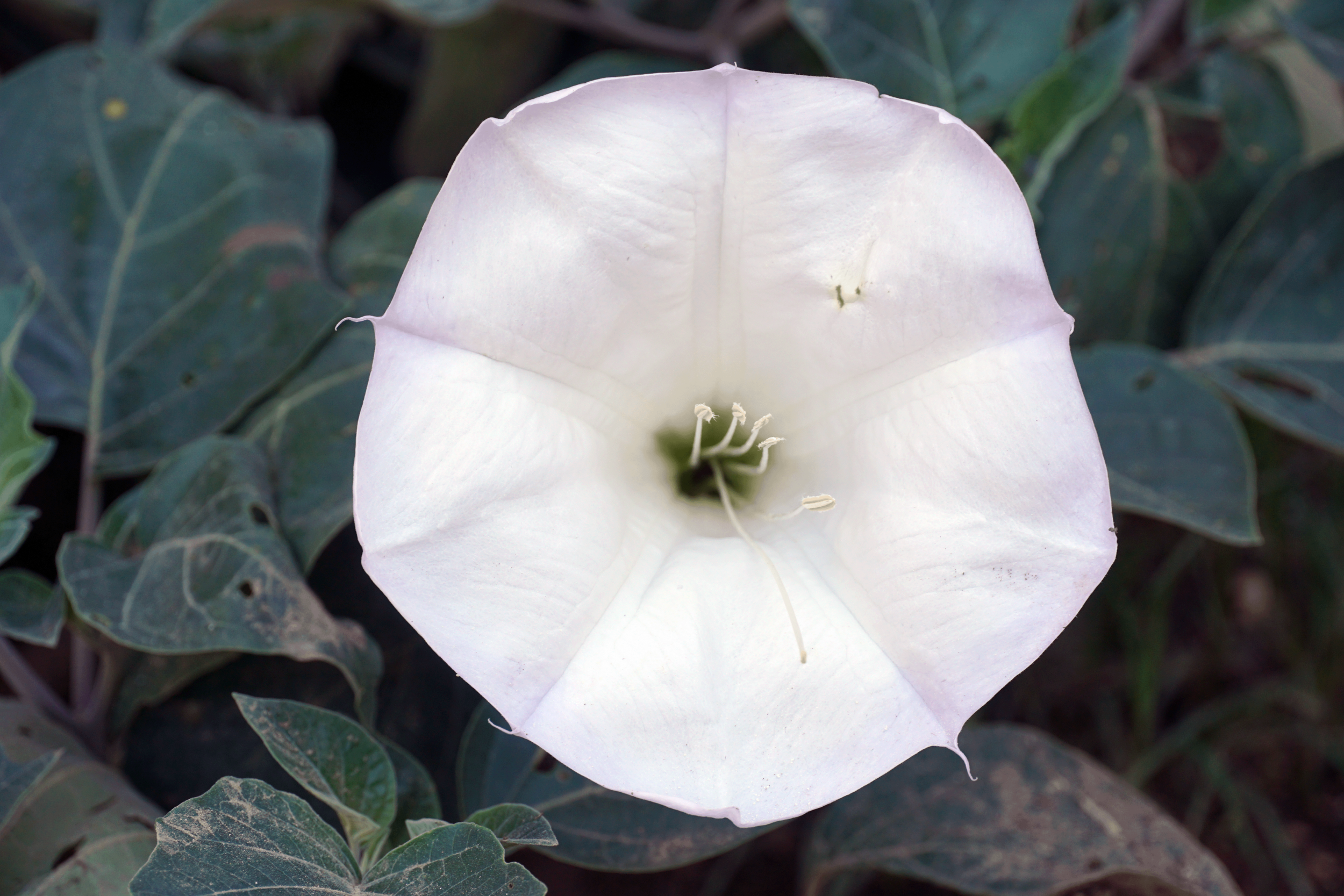
Datura / Sacred Datura / Jimsonweed / Toloache
Datura wrightii
This is a work-in-progress database that records and categorizes the plant species present throughout the Arcosanti land. It is meant to be a tool for learning about, engaging with, stewarding and (when necessary) managing, the local plant communities. The goal is to make it accessible to the Arcosanti community and site visitors to encourage informed and mindful engagement with the plant world.
Traditionally, knowledge about the land is developed over countless generations and passed down orally. The driving motivation for the database was to address the loss of valuable, slow to develop knowledge, that happens when you have a highly transitory community like Arcosanti. In a way the database is a living archive of information and stories about our plant relatives and our relationships to them - an essential tool for a land based community dealing with the fragmentation and loss of knowledge.
Individual plant profiles contain the following information in order to facilitate filtered searches of particular categories of plants:
Common name(s)
Scientific name
Family
Observed location on the property
Type (grass/cactus/succulent/wildflower/shrub/tree/vine/herb/weed)
Classification (native/naturalized/non-native/invasive)
Elevation range
Bloom time and color
Duration (annual/biennial/perennial)
Size
Uses (food/medicine/tool/fiber)
Harvest period
Habitat
USDA hardiness zone
Native and non-native range
Arcosanti seed bank availability
On site management of plant
In addition, the profiles include photographs and a general description of different parts/stages of the plant, information on how to harvest responsibly, process, propagate and grow the plant/seeds and a section tittled plant diaries where users can make entries of how they’ve engage with the specific plant. For example, an Arcosanti resident made an entry in the Western Soapberry plant profile about how they make soap from the berries - recording the process from harvest of the berries to the finished product.